Biodiversity and Waterway Projects
- Details
- Written by: Teela Griffin Penrith City Council (02) 4732 7777 (02) 4732 7958 council@penrithcity.nsw.gov.au https://www.penrithcity.nsw.gov.au 601 High St Penrith NSW 2750 Australia

Koala monitoring
Many koalas have been spotted in the Penrith local government area in bushlands and residential areas near bush.
Mulgoa Valley was identified as an important corridor that links koala populations in the south to those in the Blue Mountains. The NSW Koala Recovery Program identified the area as a priority habitat.
Since 2023, Council has worked in collaboration with Mulgoa Valley Landcare Group to survey Mulgoa Valley for the presence of koalas.

Image by Lisa Harold from Mulgoa Valley Landcare Group
Song Meter Micros project
Song Meter Micros are acoustic wildlife recorders installed in bushland areas during koala breeding season (August to February) to capture koala night sounds.
We deploy them in a bushland area for a few weeks before sending the recordings to scientists at NSW Department of Primary Industries to analyse. This is one way to determine whether koalas were present during this time.
When male koalas are actively seeking a mate, they make loud calls to try to attract a female. These calls, known as ‘bellows’, are deep, guttural sounds that can be heard from a distance.
Capturing these sounds can tell us if there is a breeding population in Mulgoa Valley.

Image: Song Meter Micros attached to the trunk of a tree
What does a male koala’s bellow sound like?
It’s a deep, guttural sound. Check out Science for Wildlife’s YouTube video to hear a male koala romancing a female.
Habitat Restoration project
Mulgoa and the Lower Blue Mountains were identified as priority areas for koala recovery investment.
Mulgoa Valley Landcare Group has been awarded $50,000 from NSW Government’s Koala Strategy to undertake habitat restoration at 5 locations in Mulgoa Valley. Works are due to commence in 2026.
The grey gum (Eucalyptus punctata) is one of the favoured ‘food trees’ for koalas. It’s abundant in Mulgoa and is easily identified by the beautiful apricot hues on trunk when old bark falls away.
More information about koalas
Find further information about koala tracking at Science for Wildlife’s webpage.

(Image, Grey Gum (Eucalyptus punctata) by Lisa Harold)
Koalas in Penrith
Emily
She was found on a roof in Emu Heights in December 2023. Emily was very young at the time and was taken into care. She was released into Glenbrook National Park.
If you spot a koala or any wildlife, please do not approach them. Call WIRES on 1300 094 737 so a trained handler can come out and remove the animal as safely as possible.

Image: Emily the koala by local wildlife photographer Henry Cook
Martin
He was found in Mulgoa in 2018. After he was health-checked, he was released back in Mulgoa Valley, away from Mulgoa Road.
Volunteers radio-tracked him for 4 months, where he reached the Thirlmere/Buxton area before tracking was lost. He was a ‘man on a mission’, and we believe he was heading back to his colony at Campbelltown.

Image, Martin by Henry Cook
Tangle bins
Platypus have been spotted living in Penrith’s waterways, with Western Sydney University (WSU) confirming the sightings and many of our residents reporting them in our creeks and rivers.
But some platypuses have been found injured from discarded fishing lines and lures in the waterways.
Penrith City Council collaborated with Ozfish to install tangle bins along the Nepean River in an effort to protect the platypus and other wildlife that live in our rivers and creeks.

Image: Platypus swimming in the Nepean River by Tracy Middleton
What is a tangle bin?
They are small bins specially designed for the safe disposal of fishing line, hooks, lures, washed out bait packages, sinkers and swivels. By being located close to popular fishing spots they make it easier for fishers to do the right thing and discard these items safely.
What does a tangle bin look like?
They are small, green bins placed against a dark green Penrith City Council signage.

Image: A tangle bin, photo by Penrith City Council
Why should we use the tangle bins?
When fishing tackle is disposed of correctly, it helps keep your favourite fishing spots clean and safe for wildlife, such as the platypus, people and dogs.

Image: A platypus with a lure caught in its web. Photograph by Dr Michelle Ryan
The tangle bins will help avoid wildlife sustaining such injuries. It's important that we make sure that our waste is disposed of correctly, including fishing waste.
Where are the bins located?
We’ve placed them close to popular fishing spots.
Tangle bins can be found along the Nepean River at:
- Devlin Road
- Penrith Weir
- Tench Reserve
- Fowler Reserve
- Penrith boat ramp
- River Road (southern jetty)
- River Road (kayak launch deck).
Will the bins be checked?
They will be monitored for usage and audited to see the amount and types of fishing waste being disposed.
The fishing waste collected from the bins will be recycled, where possible, through the OzFish Tackle Loop program.
Ecological waterway health monitoring
Penrith is home to the Nepean River, Wianamatta-South Creek and numerous tributaries. These waterways are popular for recreation activities like boating, fishing, hiking and picnicking as well as providing habitat for local plants and animals.
Ecological waterway health monitoring is used to determine how healthy the waterways are for plants and animals by monitoring physical, chemical and biological components.
This is different to Council’s recreational water quality program which looks at potential hazards towards human health during recreational activities like swimming and boating.
Ecological waterway health monitoring project
Penrith City Council samples 15 sites throughout the Penrith local government area on a biannual basis.
The project conducts long-term ecological health monitoring and macroinvertebrate sampling. Macroinvertebrates are animals without a backbone and are large enough to be seen. They live in or near water. These animals include aquatic insects, worms and snails.
Sampling monitors changes in waterway health over time and collects data that will be used to help improve the waterways.
Monitored sites for sampling
We’re monitoring the following sites:
- Shaws Creek, Hawkesbury Heights
- Mulgoa Nature Reserve, Glenmore Park
- Schoolhouse Creek Regentville
- Nepean River at Devlin Road, Castlereagh
- Jerrys Creek, Wallacia
- Nepean River at Tench Reserve, Jamisontown
- Peach Tree Creek, Penrith
- South Creek at St Marys Road, Berkshire Park
- South Creek at the Kingsway, St Marys
- South Creek at Luddenham Road, St Clair
- Unnamed creek, Dunheved Golf Course
- Dunheved Creek, Dunheved Industrial Estate
- Werrington Creek, Werrington (behind sporting complex)
- Nature Reserve, Mulgoa Rise
- Claremont Creek at Castle Road, Orchard Hills
Council's WSUD projects
Water Sensitive Urban Design (WSUD) is the sustainable management of water in urban areas through intelligent and integrated design. It considers all aspects of the urban water cycle including potable (drinking quality) water, rainwater, wastewater, stormwater and groundwater.
In July 2013, Council was successful in receiving $1.8 million in funding from the Australian Government to undertake a restoration project over four years. The project aimed to restore a regionally significant wetland (“Wetland 156”) and adjacent Cumberland Plain Woodland bushland. The project has improved the quality of water entering the Penrith Lakes and the Hawkesbury-Nepean System and increased the amount and quality of habitat for wetland flora and fauna. It will also improve the condition and resilience of the bushland and increase its extent through bush regeneration, revegetation and associated activities. Improving community access and appreciation of the reserve has also been a key objective.
The initial focus of this project was on stormwater treatment because the site is immediately upstream of the Penrith Lakes system, as well as to improve the condition of a regionally significant natural wetland and adjacent Cumberland Plain Woodland. In addition, this stormwater treatment project provides opportunities for a range of other ecological and community liveability benefits. It has also significantly improved and activated the site with features such as walking paths, a viewing platform, a bird hide and informative signs and sculptures.
Mountain View Reserve is now a highly valued community asset with significantly improved amenity. Stormwater runoff from the surrounding urban area is treated through a swale, a raingarden and a constructed wetland, and the natural wetland on site is now more resilient and home to many more birds, reptiles and frogs. Sugar gliders have also been found in the bushland on the site. The presence of these animals demonstrates the great work that has been undertaken across the whole reserve to help restore its natural areas in what is a great outcome for our City.
More information on the project is at the following link.https://www.penrithcity.nsw.gov.au/waste-environment/environment/biodiversity
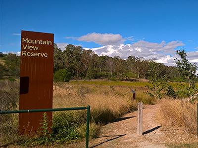
Mountain View Reserve
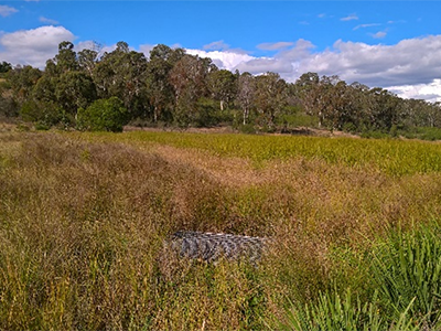
Constructed Stormwater Treatment Wetland
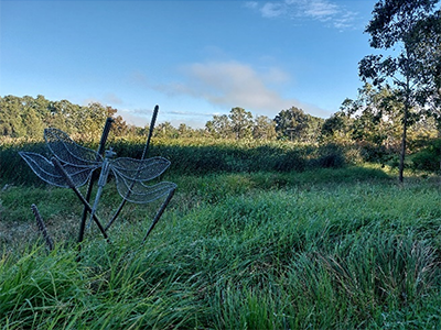
Constructed Wetland
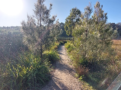
Walkway between the wetlands
Peach Tree Creek had become highly eroded which had become unstable and unsafe to the public. To mitigate the risk bank stabilisation and revegetation works were completed over a 140-metre length of the Peachtree Creek Riparian Corridor located within Weir Reserve adjacent to the Penrith Rowing Club.
The project’s key objectives were to:
- Stabilise the eroding banks and protect public and private assets from stream processes of deepening and /or widening
- Improve public safety along the subject reach riparian zone, and
- Provide appropriate access to the waterway for operations and maintenance
Key benefits of the project include reduced soil entering the Nepean River as a result of erosion, improved ecological integrity of the creeks riparian corridor and an improvement to public safety within Weir Reserve.
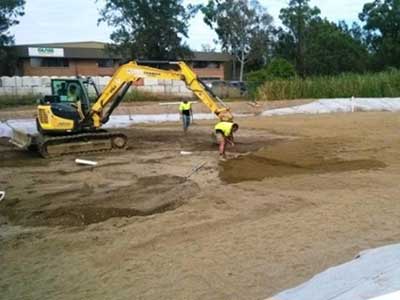
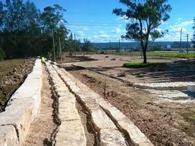
The works involved the excavation and reshaping of the eroded and unstable creek bank. The newly reshaped bank was then armoured with large rocks to ensure its long-term stability, before being revegetated with native vegetation.
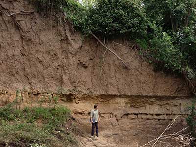
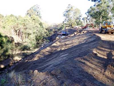
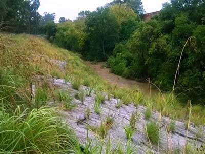
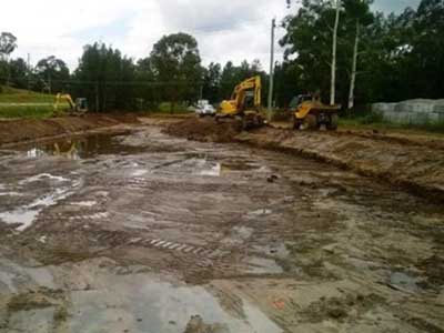
The project was completed in April 2015. The photos show the various stages of the construction process and include a design of the restoration works.
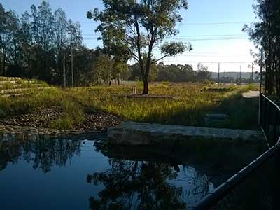
The image below depicts Peach Tree Creek in 2026, demonstrating the positive results of bank stabilisation and ongoing waterway improvement efforts.

Andrews Road Bioretention Basin
To improve stormwater entering Waterside Lakes development, Penrith Lakes and the Nepean River council constructed a 2,400m2 bioretention basin along Andrews Road. The project was allocated $1.2million and funded through councils Stormwater Management Service Charge. The bioretention basin was designed with a low flow diversion which assists in capturing litter, the main basin uses layers of soil and gravel for filtration and is planted with a combination of native plants and grasses. The plants and filter material remove nitrogen and phosphates from the stormwater. The bioretention system treats and reduces the amount of stormwater that would otherwise wash pollutants into our rivers and creeks
For further information on how bioretention basins please refer to the What is a Bioretention system and what does it do? fact sheet.