South Creek floodplain plan on show
- Details
- Written by: Philippa Borland Penrith City Council (02) 4732 7777 (02) 4732 7958 council@penrithcity.nsw.gov.au https://www.penrithcity.nsw.gov.au 601 High St Penrith NSW 2750 Australia
Wednesday, 30 October 2019
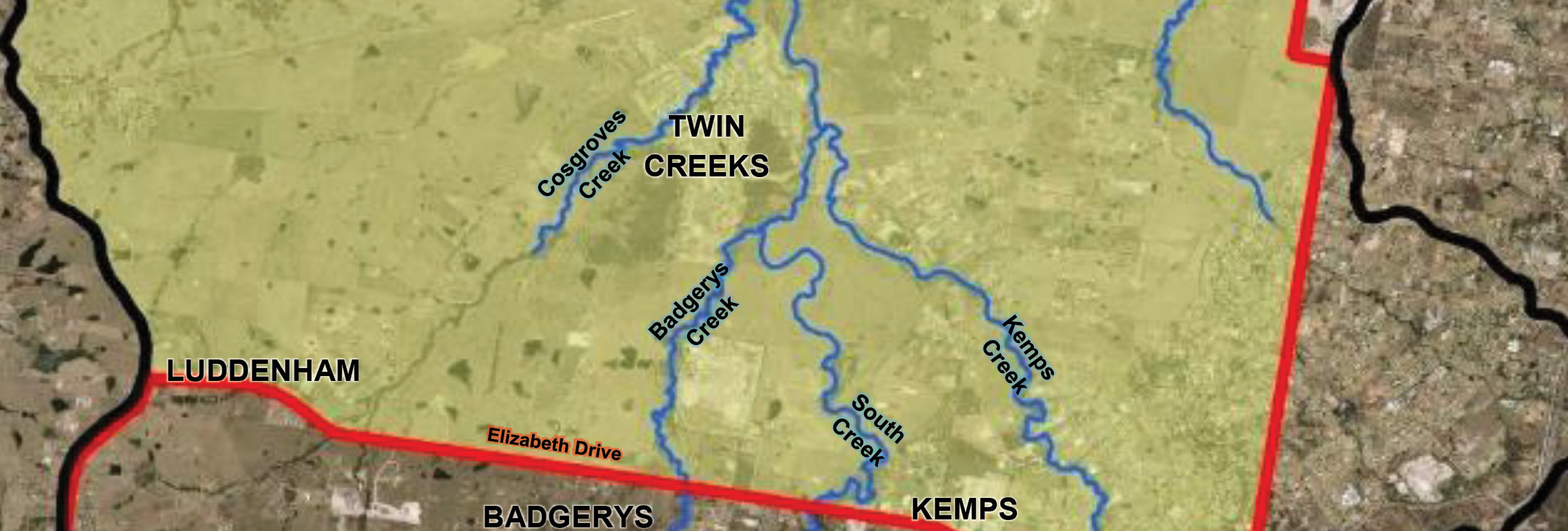
Penrith City Council is in the final stages of preparing a floodplain risk management study and plan for the South Creek floodplain, which stretches from Berkshire Park to Luddenham.
“Planning for potential flood events is one of the many ways Penrith Council takes action to protect its residents and ensure they are prepared for natural disasters,” said Penrith Mayor Ross Fowler OAM.
“Making sure the drainage infrastructure is capable of handling heavy rainfall and procedures are in place in case of flooding is essential to the safety and well-being of our residents.
“This is why we want to make sure affected residents have the opportunity to comment on floodplain management plans that affect their area.
“This transparent approach to local flood planning is designed to ensure our residents are fully informed about what is happening in their neighbourhood.
“Community consultation is an important part of Council planning. By including local feedback means we can develop plans that are relevant and include information that only local residents can provide.
“This is why we have written to residents in the South Creek catchment area, seeking their comments on the draft study and plan,” he said.
Background Information
Letters and a factsheet containing a summary of the draft floodplain risk management study and plan have been sent out by mail to all those living within the study area. The information is also on the council web page and people living in those areas are encouraged to come along to drop-in sessions.
They will be held at St Marys Memorial Hall, Corner of Great Western Highway and Mamre Road, St Marys on Wednesday 13 November 2019, from 6pm-8pm and at Llandilo Community Hall, 257c Seventh Avenue, Llandilo on Thursday 14 November 2019, from 6pm-8pm. In both cases, there will be a detailed presentation starting at 6.30pm.
The process also looks at making the community more resilient and prepared, including evacuation education and preparation.
The draft study reports can be viewed:
- Online
- In person at
- Penrith Library and Civic Centre, 601 High Street, Penrith, or
- St Marys Library, 207-209 Queen St, St Marys.
The South Creek study area covers that part of the South Creek floodplain in the Penrith LGA bounded by Elizabeth Drive to the south, The Northern Road to the west, Ropes Creek to the east and Blacktown Road/Richmond Road to the north. The study area covers the suburbs of Berkshire Park, Llandilo, Werrington, Werrington County, St Marys, Oxley Park, Claremont Meadows, St Clair, Erskine Park, Twin Creeks, Mount Vernon and Luddenham.
Information contained within this news release was correct as at Wednesday, 30 October 2019.