Bushfire Prone Land map updated
- Details
- Written by: Adam Gatt Penrith City Council (02) 4732 7777 (02) 4732 7958 council@penrithcity.nsw.gov.au https://www.penrithcity.nsw.gov.au 601 High St Penrith NSW 2750 Australia
Tuesday, 17 December 2024
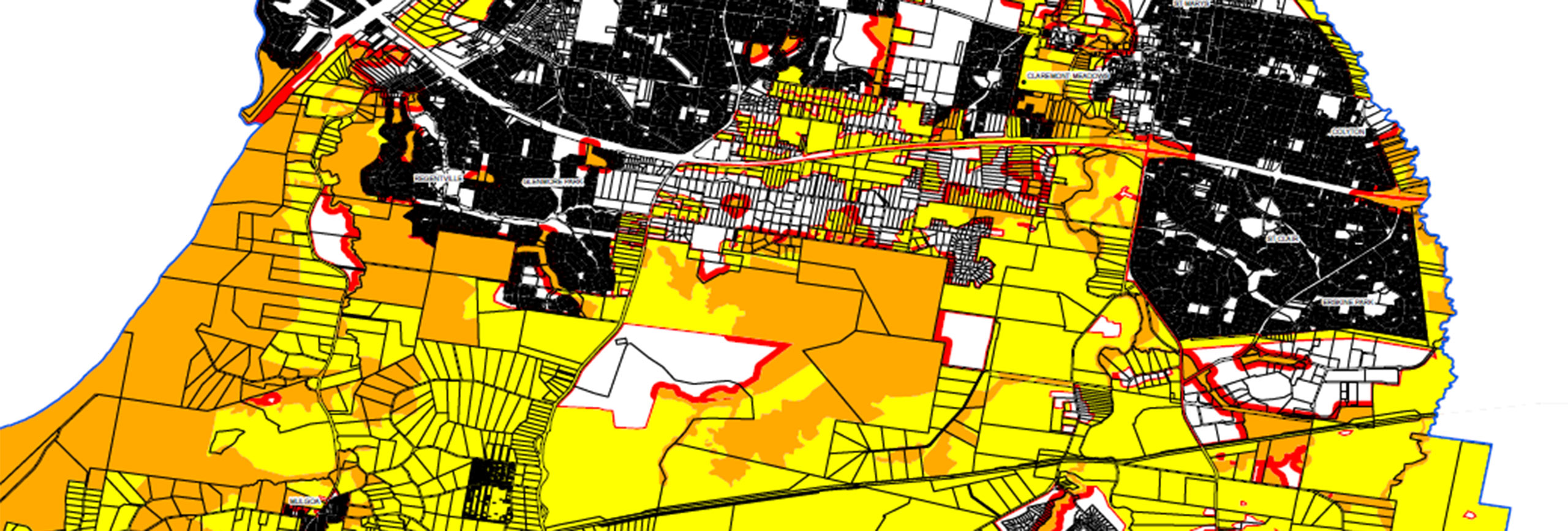
The NSW Rural Fire Service have recently certified a revised Bushfire Prone Land map, covering the whole of the Penrith Local Government Area.
The revision took into account requirements for mapping to recognise areas classified as vegetation Category 3 - grassland areas, as well as other vegetation, to carry bushfires into areas of residential development that have potential to present notable fire risks.
The changes do not affect land owners unless they lodge an application for development on their property. Where land is mapped as bushfire prone, a property risk assessment will be carried out as part of the DA process.
Once an assessment of the site has been undertaken, a Bushfire Attack Level (BAL) is nominated for the development, and the Bushfire Protection Measures (BPM) required can be determined. These may include incorporating building elements to protect the structure, providing an asset protection zone or cleared area, providing a fire fighting water supply and providing safe entry to and exit from the property.
More often than not, a combination of these is used to ensure the development is safe for the occupants and fire fighters. The Bushfire Prone Land map has been certified by Council and the Commissioner of the Rural Fire Service.
Download the Bushfire Prone Land Map, or view a hard copy at Council's Penrith and St Marys offices. For further information contact Council's Development Services Department on 4732 7991.
Information contained within this news release was correct as at Tuesday, 17 December 2024.